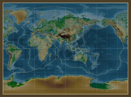
Tectonic plate boundaries on a physical map of ... 

Media-ID: B:671874936
Nutzungsrecht:
Kommerzielle und redaktionelle Nutzung
Tectonic plate boundaries on a physical map of the world in the Miller Cylindrical projection centered on the meridian 90 east longitude
| Vorschau |
Varianten
Mediainfos
|
Dieses Bild mit unserem Kundenkonto ab $1.25 herunterladen!
|
||||
| Standardlizenz: JPG | ||||
| Format | Bildgröße | Downloads | ||
|
Print XXL 15 MP |
3877x2880 Pixel 32.83x24.38 cm (300 dpi) |
1 | ||
| Standardlizenz: JPG | ||||
| Format | Bildgröße | Netto | Brutto | Preis |
|
Web S 0.5 MP |
500x371 Pixel 16.93x12.56 cm (75 dpi) |
$5.15 | $5.50 | |
|
Print M 2 MP |
1000x743 Pixel 8.47x6.29 cm (300 dpi) |
$9.11 | $9.74 | |
|
Print XL 8 MP |
2000x1486 Pixel 16.93x12.58 cm (300 dpi) |
$17.03 | $18.22 | |
|
Print XXL 15 MP |
3877x2880 Pixel 32.83x24.38 cm (300 dpi) |
$20.99 | $22.45 | |
| Merchandisinglizenz: JPG | ||||
| Format | Bildgröße | Netto | Brutto | Preis |
|
Print XXL 15 MP |
3877x2880 Pixel 32.83x24.38 cm (300 dpi) |
$105.47 | $112.85 | |
| Media-ID: | B:671874936 |
| Aufrufe: | 1 |
| Beschreibung: | Tectonic plate boundaries on a physical map of the world in the Miller Cylindrical projection centered on the meridian 90 east longitude |
Nutzungslizenz
| Nutzungsrecht: | Kommerzielle und redaktionelle Nutzung |
Userinfos
| Hinzugefügt von: | Yarr65 |
| Weitere Medien von Yarr65 |
Bewertung
| Bewertung: |
|
Suchbegriffe
| Keywords: |


